
Beacon Rock State Park —
Your Complete Guide
A volcanic monolith with a trail to the top, a waterfall hike up Hamilton Mountain and 26+ miles of trails in the Columbia River Gorge.
What is Beacon Rock State Park?
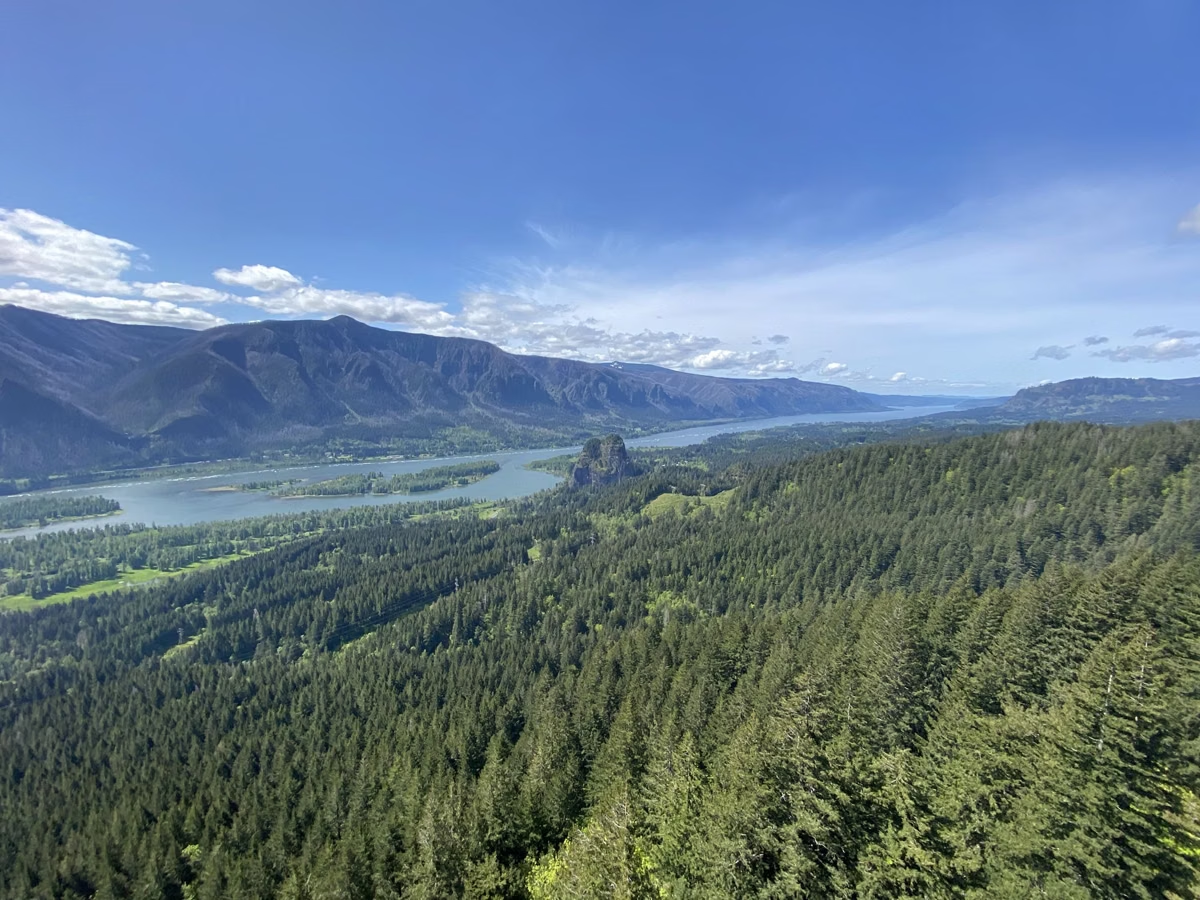
Beacon Rock State Park is a 4,458-acre park in the Columbia River Gorge on State Route 14 near Skamania, Washington, about 40 minutes from Portland and Vancouver. Its namesake, Beacon Rock, is the core of an ancient volcano that rises more than 840 feet above the river; a 1.8-mile round-trip trail climbs it on 52 switchbacks. There is no entrance fee, but parking needs a Discover Pass, $10 a day or $45 a year. The park is open 8 a.m. to dusk all year.
Across the highway from the rock, the Hamilton Mountain Trail passes Rodney Falls, Hardy Falls and the Pool of the Winds on the way to a 2,438-foot summit (Hamilton Mountain, the waterfalls). The park also has 13 miles of bike trails, horse trails, technical rock climbing, a boat launch and moorage on 9,500 feet of Columbia River shoreline (Doetsch and the river), and campgrounds first built by the Civilian Conservation Corps (camping).
Henry Biddle bought the rock in 1915 to build a trail to its top, and his family gave it to the state, which accepted the land in 1935 (park history). Note for fall to spring: the Beacon Rock Trail closes on Tuesdays, Wednesdays and Thursdays from October 1 through the end of May for deck replacement (trail details). This is an independent guide; the official source is Washington State Parks.
Beacon Rock State Park at a Glance
What to Do at Beacon Rock State Park
Climb the rock, hike to waterfalls, camp under old firs, climb, ride or put a boat in the Columbia.

Beacon Rock Trail
1.8 miles round trip on 52 switchbacks, railings and bridges to the summit view of the Gorge.
Climb the Rock →
Hamilton Mountain
6.4 miles round trip to a 2,438-foot summit, or a loop past The Saddle.
Summit Hike →
Pool of the Winds
Rodney Falls, Hardy Falls and the Pool of the Winds, 2.52 miles round trip from the trailhead.
The Waterfalls →
Camping
A forested 1935 CCC campground, five full-hookup sites at Woodard Creek, a group camp and an equestrian camp.
Campgrounds →
Rock Climbing
Traditional climbing on the rock's south, southeast and northwest faces, with seasonal falcon closures.
Faces & Closures →
River & Doetsch
A flat, paved 1.2-mile loop by the river, plus the boat launch and moorage dock.
Day Use & Boating →Trails at Beacon Rock
26+ miles of roads and trails for hiking, mountain biking and horseback riding. Distances below are the agency's round-trip figures.
52 switchbacks built onto the rock face, 1915 to 1918.
Old-growth fir, three waterfalls and a summit view of the Gorge.
The waterfall half of the Hamilton Mountain Trail.
Flat and accessible, with interpretive panels on the Ice Age floods.
How to Get to Beacon Rock State Park
About 40 minutes east of Portland and Vancouver on Washington State Route 14.
By Car
34841 State Route 14, Skamania, WA 98648. Separate lots at each trailhead. Parking and directions.
Discover Pass
$10 a day or $45 a year, sold at the park's automated pay station. Hours and fees.
Park Office
Phone (509) 427-8265, email Beacon.Rock@parks.wa.gov. Plan your visit.
Frequently Asked Questions
Is Beacon Rock State Park free?
There is no entrance fee, but parking needs a Discover Pass: $10 for one day or $45 for a year. The park has an automated pay station that takes cash and cards. Registered campers don't need a pass in the park they're staying in.
Where is Beacon Rock State Park?
At 34841 State Route 14, Skamania, WA 98648, on the Washington side of the Columbia River Gorge, about 40 minutes from Portland and Vancouver. State Route 14 runs through the park between the rock and Hamilton Mountain.
How long is the Beacon Rock hike?
1.8 miles round trip on 52 switchbacks. Washington State Parks rates it easy to moderate. From October 1 through the end of May it closes on Tuesdays, Wednesdays and Thursdays for deck replacement.
What are the hours at Beacon Rock?
8 a.m. to dusk all year. Trails are open 8 a.m. to dusk, and campers may enter the park until 10 p.m.
Are dogs allowed at Beacon Rock State Park?
Yes, on a leash. Washington State Parks allows leashed dogs in the park.
Can you camp at Beacon Rock?
Yes. The Upper Campground has 25 standard sites and a hiker/biker site from April 1 to October 15; the Woodard Creek Campground's five full-hookup and two standard sites are reservable all year.
How tall is Beacon Rock?
It rises more than 840 feet above the Columbia River. It is the hard core of a cinder cone that erupted about 57,000 years ago, left standing when the Ice Age floods stripped away the rest.